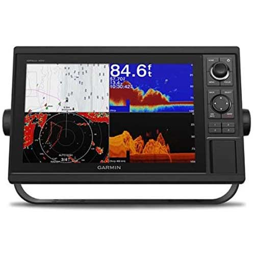
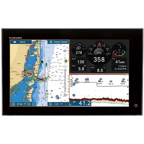
The Furuno NavNet TZtouch2 12-Inch Chartplotter / Fishfinder offers a sleek all-glass front, refined graphical user interface, built-in RezBoost Fish Finder, and an internal GPS antenna, NavNet TZtouch2 is a beauty to behold and use.
Furuno NavNet TZtouch2 12-Inch ChartPlotter / FishFinder
$2,695.00
Description
Furuno NavNet TZtouch2 12-Inch ChartPlotter / FishFinder
Whether you are searching for hot fishing grounds, plotting your next route, or using your Radar to navigate through fog, the Furuno NavNet TZtouch2 12-Inch Chartplotter / FishFinder delivers smooth operation with familiar touch gestures. Sporting and edge-to-edge glass front, NavNet TZtouch2 is beautifully designed, allowing you to build a navigation suite that is not only functional but offers a luxurious look and feel.
- 12.1″ or 15.6″ multi-touch display with edge-to-edge glass for a clean and stylish installation
- Bonded LCD for fog-free clear readability and polarized friendly
- Built-in RezBoost Fish Finder – 50/200kHz, 600 W/1 kW output
- Built-in 56 channel GPS/WAAS receiver
- Wireless connectivity for Android and iOS apps
Simply refined, simply beautiful
Following in the footsteps of the original NavNet TZtouch, TZtouch2 features a refined user interface that is all about usability. Elegantly designed, NavNet TZtouch2 allows you to build a navigation suite that is not only functional but offers a luxurious look and feel. Taps, swipes, pinches, and custom multi-touch gestures are instantly transformed into action, giving you full control of every component connected to your network.
Incredibly easy-to-use graphical user interface
The Furuno NavNet TZtouch2 12-Inch Chartplotter / FishFinder Multi-Touch graphical user interface sets a new benchmark for “easy to use” in the marine electronics industry. This interface is not only intuitive but is as easy to use as the phone in your pocket. With taps, slides, and swipes, you will be up and using your TZtouch2 in no time at all. Menus and other features slide out from each of the sides of the screen, ensuring that the most important tasks are literally right at your fingertips.
Powerful Fish Finder with built-in Furuno features
The built-in Fish Finder is a dual-frequency (50/200kHz), 600W/1kW power output sounder. It includes Furuno’s unique Bottom Discrimination and AccuFish modes and also incorporates another new Furuno proprietary Fish Finder technology, called RezBoost. RezBoost is a revolutionary new feature that utilizes Furuno’s exclusive digital signal processing protocol to produce fantastic target resolution and separation, without the need to change out your transducer or purchase expensive broadband transducers. With RezBoost, you can now achieve target separation and resolution that was previously limited to Furuno commercial-grade Fish Finders.
Freedom to build the helm of your dreams
NavNet TZtouch2 is a component-based system that utilizes Furuno’s award-winning network products. You can add a variety of UHD Radars, from a 4kW NXT Dome up to a 25kW X-Class Open Array. As with NavNet TZtouch, you can integrate, display, and control the NavPilot Autopilot, and Furuno’s FI70 Instrument. Both of these products have displays that match TZtouch2, giving your helm a beautiful all-glass finish. Additional sensors that can be added to the network include AIS, Weather Fax, Sirius/XM Satellite Weather, Fusion Marine Stereo, and IP Cameras, as well as NMEA2000 and Furuno, CAN bus devices. It even includes one NMEA0183 output port to send data to legacy systems.
Remotely view and control your bridge
Engineered to utilize the latest technology, NavNet TZtouch opens the door to cutting edge WiFi features, such as tablet and smartphone apps, points of interest (POI), real-time weather data, software updates, and more. Take full control of your NavNet in a whole new way. The TZtouch Remote app allows you to operate your system remotely with your smartphone or tablet over WiFi when connected to the network.
Satellite PhotoFusion™ offers a birds-eye view without the obstruction of critical data
You can load any two ultra-wide high-resolution satellite photo areas at your convenience. Land areas (zero depth) are completely opaque, so these areas are displayed as high-resolution satellite photos on the chart. As the depth increases, the satellite photography becomes more transparent. This allows you to see where the shallows end and the deeper water begins, while still allowing the raster or vector chart to be visible.
Free & easy-to-use marine weather forecasts
The weather tool is completely free and easy to use, giving you unlimited access to weather forecasts worldwide 24 hours a day provided by NavCenter. Select geographic coverage, data type, a period of time, and then choose how to receive the file. NavNet TZtouch2 provides up to 16 days of weather forecasting.